Delta Aerial Surveys Ltd., Your Digital Mapping Specialists
Tel: 604-275-3505     
Fax: 604-275-6685      
Email: mail@deltamap.com  

Delta Mapping Home Page
Photogrammetry -

Gathering environmental and land data

through the use of aerial photography
Cartography -

Creating digital maps for a 

wide variety of software
Orthophoto - 

Creating scaled photo maps 

from aerial photography
GIS - 

A system to capture, manipulate, 

and analyze geographical data.
Viewscapes - 

Photorealistic environmental

rendering for planning purposes.
Custom or off the shelf

aerial photography.
High resolution precision scanning 

of photogrammetric imagery.
Free Sample CD
Employment  

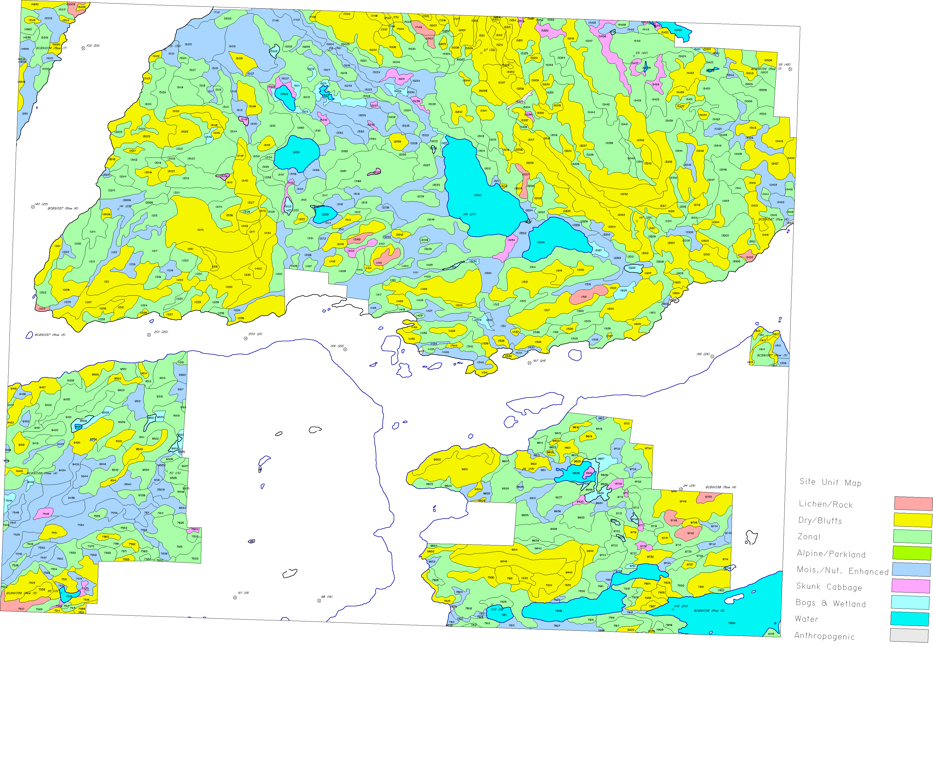
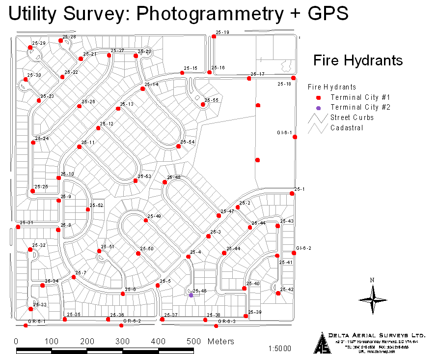
GIS Data Preparation and Manipulation

The growing utilization of Geographic Information Systems demands attention to maintaining large amounts of clean usable graphic and database information that will be accessible for querying at any time. Delta's ability to handle many formats of both data types allows us to prepare data for use with your GIS or other querying tools. We are able to edit data to suit the uses you intend it for as well as perform many of the essential functions of a GIS system in house, so data can be error checked, filtered, and even thematically processed from raw digital data or existing paper maps.